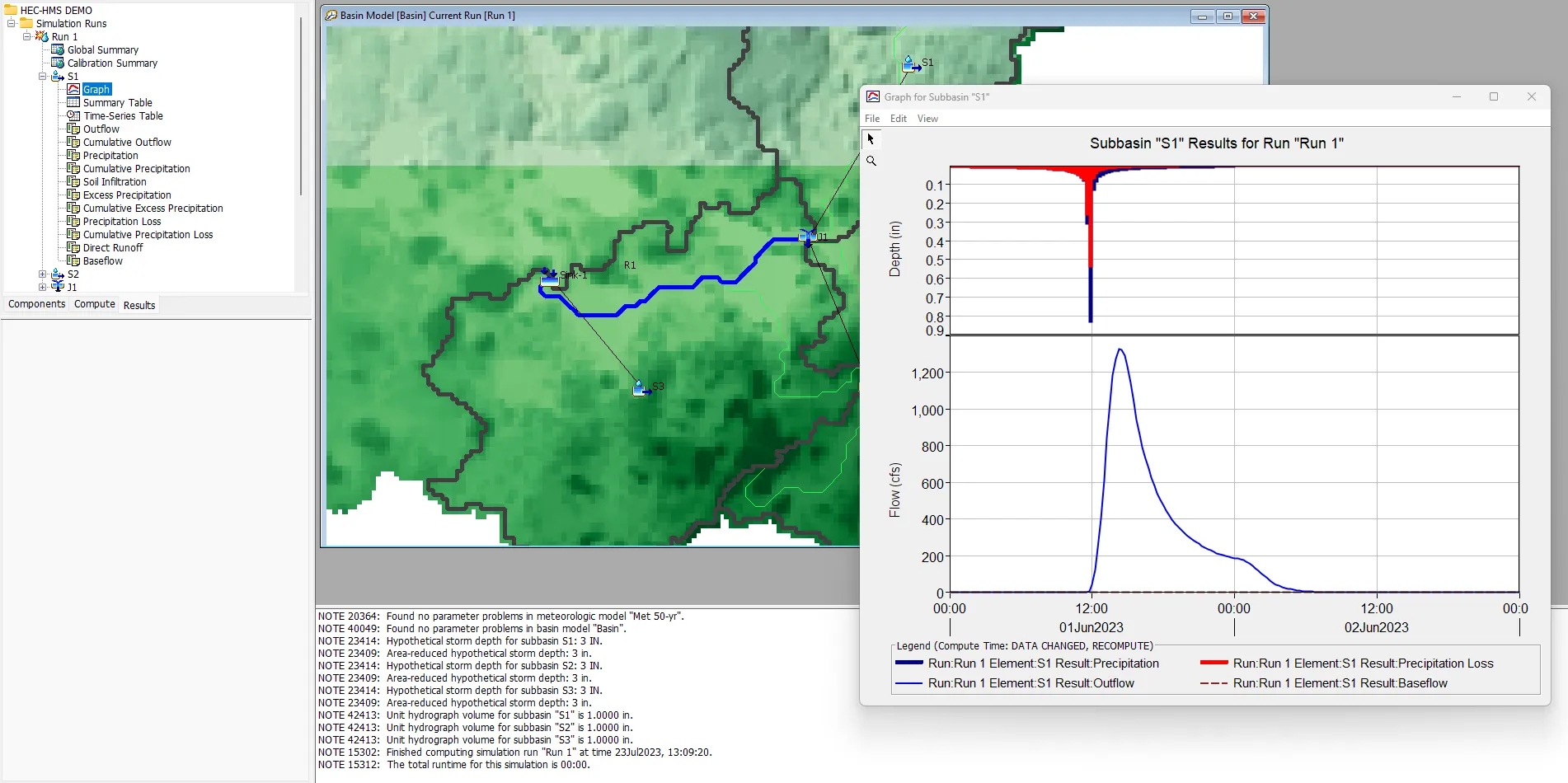
// main lessons

The two long-form lessons

Each video covers a complete workflow. Together they take you from a blank HEC-HMS project to a calibrated model.

01

HEC-HMS 101: a step-by-step tour of watershed modeling

A full walk-through of building an HEC-HMS model end to end. We cover data requirements, watershed delineation, model setup, hydrologic methods, control specifications, the model run, and how to read the results. Useful as a first introduction and as a refresher.

02

Model development and optimization with an observed hydrograph

How to set up an HEC-HMS model and then optimize it against an observed streamflow hydrograph.

  • Build the hydrologic model: precipitation, evaporation, infiltration, runoff generation, routing, channel flow, sub-basins, and hydrologic response units.
  • Choose which model variables to adjust in order to meet the optimization objective.
  • Pick an appropriate optimization method or algorithm.
  • Run the optimizer iteratively: it varies the decision variables within the constraints, runs the simulation, evaluates the objective, and adjusts on each pass.
// other useful resources

Supporting workflows

The pieces that come up while you build an HEC-HMS model: getting the input data, computing Curve Numbers, picking the design storm, and the theory behind Unit Hydrographs.

01

Download and process soil data for your watershed

How to download and pre-process SSURGO soil-texture data for hydrologic and watershed modeling. Soil characteristics drive infiltration and runoff, so getting them right early pays off later.

02

Download and process land use and land cover data for your watershed

A step-by-step walk-through of getting and preparing NLCD land use and land cover data for hydrologic and watershed analysis.

03

Create a Curve Number raster with ArcHydro in ArcGIS Pro

How to use ArcGIS Pro and ArcHydro together to build a Curve Number raster for your study area.

04

Curve Numbers from land use and soil data with the ArcGIS Pro built-in tools

The Curve Number method estimates stormwater runoff from land use, soil type, and antecedent moisture conditions. It is widely used in stormwater management, flood control, and watershed modeling. Values come from established tables; this video shows how to compute a CN map from those tables in ArcGIS Pro using the built-in tools.

05

NRCS Curve Number method: the theory

The NRCS (formerly SCS) Curve Number method is an empirical approach for predicting rainfall excess and infiltration. The four videos below build the theory; watch in order.

Part 1 of 4
Part 2 of 4
Part 3 of 4
Part 4 of 4
06

Download NOAA Atlas 14 rainfall-frequency estimates from PFDS

How to download NOAA Atlas 14 rainfall-frequency estimates from the Precipitation Frequency Data Server (PFDS) for hydrologic and watershed modeling. Choosing the design storm is one of the first steps in a hydrologic study.

07

Unit Hydrograph theory and application

A two-part series. Part 1 covers the theory and assumptions behind Unit Hydrographs. Part 2 shows how to build and use one in a modeling project.

Part 1 of 2
Part 2 of 2

Questions on a specific step, or a request for the next video on the channel? Email me. More tutorials and the Python course are on the tutorials page, and recorded course lectures are on the teaching page.

← Back to all tutorials